Via R527
Approx 18.6kms - 20 min drive
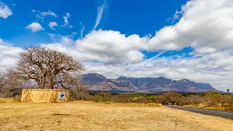
All Baobabs are deciduous trees ranging in height from 5 to 20 meters. The Baobab tree is a strange looking tree that grows in low-lying areas in Africa and Australia. It can grow to enormous sizes and carbon dating indicates that they may live to be 3,000 years old
Via R527 & R36
Approx 44.2kms - 37 min drive
Discovered in 1923 by a farmer searching for a source of water, Echo Caves is a fascinating site to visit. The cave consists of impressive stalactite and stalagmite formations which can be viewed comfortably from walkways with electric lights, railings & staircases. Most recent discoveries include the Madonna and Crystal Palace chambers. The most strenuous walk is to the Crystal Palace which is also one of the most beautiful halls in the cave. Guided tours are available daily from 08h30 to 16h00 and last for around 45mins to an hour
via R527 & R36
Approx 71kms - 1 hour 05 min drive
Discovered in 1923 by a farmer searching for a source of water, Echo Caves is a fascinating site to visit. The cave consists of impressive stalactite and stalagmite formations which can be viewed comfortably from walkways with electric lights, railings & staircases. Most recent discoveries include the Madonna and Crystal Palace chambers. The most strenuous walk is to the Crystal Palace which is also one of the most beautiful halls in the cave. Guided tours are available daily from 08h30 to 16h00 and last for around 45mins to an hour
via R527, R36 & R532
Approx 92kms - 1 hour 20 min drive
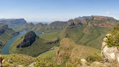
The Three Rondavels are an ancient geological wonder located in South Africa’s Blyde River Canyon region. The trio of portly peaks are shaped like traditional beehive huts, with gently sloping walls and domed summits. Also known as the Three Sisters, they serve as reminders of the native hut housing structures called rondavels.
Situated along the famous Panorama Route in Mpumalanga, the Three Rondavels rock formations consist of quartzite and shale. They are sometimes referred to as the ‘Chiefs Troublesome Wives’, with the flat-top peak representing the chief, Mapjaneng, and the Rondavels representing his three wives. The view from the Three Rondavels lookout point is widely considered the finest in South Africa.
via R527, R36 & R532
Approx 102kms - 1 hour 25 min drive
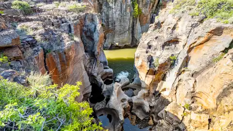
Where the Blyde River ("river of joy") and the Treur River ("river of sorrow") meet, water erosion has formed one of the most remarkable geological phenomena -- Bourke's Luck Potholes. Over thousands of years, surreal cylindrical rock sculptures created by whirling water, when the once rapid river carried masses of sand and debris, have formed a series of dark pools which contrast artfully with the streaked white and yellow lichen covered rocks.
Located on the scenic Panorama Route, Bourke's Luck Potholes is one of South Africa's top tourist attractions. Access is within 50 metres of the R532.
via R527, R36 & R532
Approx 130kms - 1 hour 41 min drive
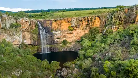
These falls tumble down in a single drop for some 80 metres, or about 260 feet, before crashing dramatically into a round basin that is an irresistible jade colour. Seeing the green waters set off by the red cliffs around them is something quite unforgettable and is best enjoyed from the observation platform above. The water comes from the Sabine River, which is popular for the bass fishing opportunities it presents.
via R527, R36 & R532
Approx 133kms - 1 hour 45 min drive
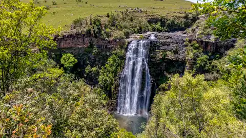
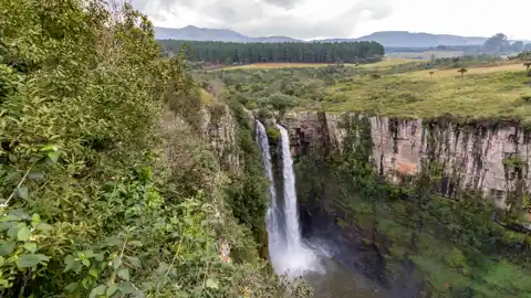
These falls are just three kilometers to the south of the Berlin Falls. The Lisbon River plunges down in a double stream, 94 meters high, over a semicircular rock face and are the highest waterfalls in Mpumalanga.
There is a 100-meter footpath leading from the parking area to a vantage point, at the base of the falls for a really spectacular view. Nearby are some lovely picnic spots.
via R527, R36 R532 & R534
Approx 136kms - 1 hour 45 min drive
Just one look down and you will begin to understand why it is called "God's Window".
Gods Window is so called for the panoramic view of the Lowveld more than 900 m down into lush indigenous forest clad ravine. The majestic cliffs plunge over 700 meters to the Lowveld and the private game reserves which have made the area one of South Africa's main wildlife destinations. God's Window is a small part of a 250km long earthwork of sheer cliffs and extravagant beauty. One can observe the hills and forests as far as the eye can see. In fact, it seems as if one can see forever!
via R527, R36 R532 & R534
Approx 143kms - 1 hour 50 min drive
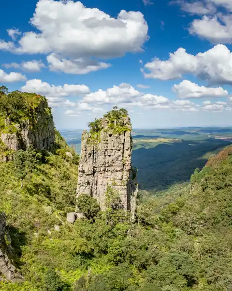
The Pinnacle Rock is a tower-like freestanding quartzite buttress which rises 30m above the dense fern clad ravine and indigenous forest
To the right, and below, the viewing plateau from which can be seen only the topmost of eight waterfalls which take the river down approximately 450m in a series of alternating falls and cascades.
via R527, R36 & R532
Approx 153kms - 2 hours drive
The 65 m high Mac Mac Falls in the Mac Mac River is a declared National Monument.
This waterfall was originally a single stream, but gold miners blasted it with dynamite to divert the river in an attempt to work the rich gold-bearing reef over which it plunges.
Toilet facilities are available at the curio stalls. The path to the viewing platform is very wheelchair unfriendly.
via R527, R36 & R532
Approx 156kms - 2 hours 4 min drive
Mac Mac Pools lies south of the Mac Mac Falls, its well grassed and have a shady picnic site with neat braai and ablution facilities. The brave can test their resilience in the freezing water in one of these naturally formed shallow swimming pools, but have to be cautious when going for a swim.
If you fancy a gentle walk, then amble along the 3km Secretary Bird Day Trail at the pools which wanders through indigenous bush. You’ll hear robins, thrushes, turacos, greenbuls, and cuckoos in summer, and if you’re lucky, you may well spot the curious looking Secretary bird which stamps snakes and small rodents to death before gobbling them down.
Pilgrim's Rest
Pilgrim’s Rest is a small museum town in the Mpumalanga province of South Africa which is protected as a provincial heritage site. It was the second of the Transvaal gold fields, attracting a rush of prospectors in 1873, soon after the MacMac diggings started some 5 kilometres away
Waterfalls near Sabie
Sabie Falls, Bridal Veil Falls, Lone Creek Falls & Horse Shoe Falls
Long Tom Cannon
At the top of the Long Tom Pass in Mpumalanga is a large cannon called The Long Tom. That was the British name for this Boer-operated field gun that fired a 38 kg shell for 10 kilometres and was the bane of British generals and their brigades.
To explore the interactive Google Map below, click any of the red numbered icons on the map or the info icon to the left on the map's menu bar:
+27 (0)79 494 6278
+27 (0)82 825 0631
ask@444ontaaibos.co.za
tracey@safarisa.co.za
444 Taaibos Street, Hoedspruit Wildlife Estate, 1380
24°20'43.4"S - 30°57'59.2"E